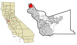
Berkeley, California
| City of Berkeley | |
|---|---|
| — City — | |
 |
|
 |
|
| Coordinates: | |
| Country | United States |
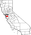
| State | California |
| County | Alameda |
| Incorporated | April 4, 1878 |
| Government | |
| - Mayor and City Council | Mayor Tom Bates Councilmembers: District 1: Linda Maio, District 2: Darryl Moore, District 3: Maxwell Anderson, District 4: Jesse Arreguin, District 5: Laurie Capitelli, District 6: Susan Wengraf, District 7: Kriss Worthington, District 8: Gordon Wozniak |
| - State Senate | Loni Hancock (D) |
| - State Assembly | Nancy Skinner (D) |
| - U. S. Congress | Barbara Lee (D) |
| Area | |
| - Total | 17.7 sq mi (45.9 km2) |
| - Land | 10.5 sq mi (27.1 km2) |
| - Water | 7.2 sq mi (18.8 km2) |
| Elevation | 0–1,320 ft (0–400 m) |
| Population (2000) | |
| - Total | 102,822 |
| - Density | 9,823.3/sq mi (3,792.5/km2) |
| Time zone | PST (UTC−8) |
| - Summer (DST) | PDT (UTC−7) |
| ZIP code | 94701–94710, 94712, 94720 |
| Area code(s) | 510 |
| FIPS code | 06-06000 |
| GNIS feature ID | 1658037 |
| Website | http://www.cityofberkeley.info |
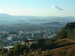
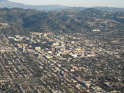
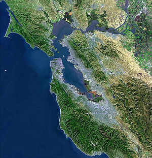
Berkeley (pronounced /ˈbɜrkli/) is a city on the east shore of the San Francisco Bay in Northern California, United States. Its neighbors to the south are the cities of Oakland and Emeryville. To the north is the city of Albany and the unincorporated community of Kensington. The eastern city limits coincide with the county line (bordering Contra Costa County), which generally follows the ridge line of the Berkeley Hills. Berkeley is located in northern Alameda County.
Berkeley is the site of the University of California, Berkeley, the oldest of the University of California system, and the Lawrence Berkeley National Laboratory. It is also home to the Graduate Theological Union. The city is noted as one of the most politically liberal in the nation, with one study placing it as the third most liberal city in the United States.[1]
Contents |
History
Early history
The site of today's City of Berkeley was the territory of the Chochen/Huichin band of the Ohlone people when the first Europeans arrived. Remnants of their existence in the area include pits in rock formations, which they used to grind acorns, and a shellmound, now mostly leveled and covered up, along the shoreline of San Francisco Bay at the mouth of Strawberry Creek. Other artifacts were discovered in the 1950s in the downtown area during remodeling of a commercial building, near the upper course of the creek.
The first people of European descent (most of whom were born in America, and many of whom were of mixed ancestry) arrived with the De Anza Expedition in 1776. Today, this is noted by signage on Interstate 80, which runs along the San Francisco Bay shoreline of Berkeley. The De Anza Expedition led to establishment of the Spanish Presidio of San Francisco at the entrance to San Francisco Bay (the Golden Gate), which is due west of Berkeley. Luís Peralta was among the soldiers at the Presidio. For his services to the King of Spain, he was granted a vast stretch of land on the east shore of San Francisco Bay (the contra costa, "opposite shore") for a ranch, including that portion that now comprises the City of Berkeley.
Luís Peralta named his holding, "Rancho San Antonio." The primary activity of the ranch was raising cattle for meat and hides, but hunting and farming were also pursued. Eventually, Peralta gave portions of the ranch to each of his four sons. What is now Berkeley lies mostly in the portion that went to Peralta's son, Domingo, with a little in the portion that went to another son, Vicente. No artifact survives of the ranches of Domingo or Vicente, although their names have been preserved in the naming of Berkeley streets (Vicente, Domingo, and Peralta). However, legal title to all land in the City of Berkeley remains based on the original Peralta land grant.
The Peraltas' Rancho San Antonio continued after Alta California passed from Spanish to Mexican sovereignty after the Mexican War of Independence. However, the advent of U.S. sovereignty after the Mexican–American War, and especially, the Gold Rush, saw the Peralta's lands quickly encroached on by squatters and diminished by dubious legal proceedings. The lands of the brothers Domingo and Vicente were quickly reduced to reservations close to their respective ranch homes. The rest of the land was surveyed and parceled out to various American claimants (See Kellersberger's Map).
Politically, the area that became Berkeley was initially part of a vast Contra Costa County. On March 25, 1853, Alameda County was created by division of Contra Costa County, as well as from a small portion of Santa Clara County.
The area of Berkeley was at this period mostly a mix of open land, farms and ranches, with a small though busy wharf by the bay. It was not yet "Berkeley," but merely the northern part of the "Oakland Township" subdivision of Alameda County.
Late 19th century
In 1866, Oakland's private College of California looked for a new site. It settled on a location north of Oakland along the foot of the Contra Costa Hills (later called the Berkeley Hills) astride Strawberry Creek, at an elevation about 500 ft (150 m) above the bay, commanding a fantastic view of the Bay Area and the Pacific Ocean through the Golden Gate.
According to the Centennial Record of the University of California, "In 1866…at Founders' Rock, a group of College of California men watched two ships standing out to sea through the Golden Gate. One of them, Frederick Billings, thought of the lines of the Anglo-Irish Anglican Bishop George Berkeley, 'westward the course of empire takes its way,' and suggested that the town and college site be named for the eighteenth-century Anglo-Irish philosopher and poet."
The College of California's College Homestead Association planned to raise funds for the new campus by selling off parcels of land adjacent to it. To this end, they laid out a plat and street grid that became the basis of Berkeley's modern street plan. Their plans fell far short of their desires, and collaboration was then begun with the State of California, which culminated in 1868 with the creation of the public University of California.
As construction began on the new site, more residences were constructed in the vicinity of the new campus. At the same time, a settlement of residences, saloons, and various industries grew around the wharf area called "Ocean View." A horsecar ran from Temescal in Oakland to the university campus along what is now Telegraph Avenue.
By the 1870s, the Transcontinental Railroad reached its terminus in Oakland. In 1876, a branch line of the Central Pacific Railroad, the Berkeley Branch Railroad, was laid from a junction with the mainline called Shellmound (now a part of Emeryville) into what is now downtown Berkeley. That same year, the mainline of the transcontinental railroad into Oakland was re-routed, putting the right-of-way along the bay shore through Ocean View.
There was a strong prohibition movement in Berkeley at this time. In 1876 the "mile limit law" was passed, which prevented sale or public consumption of alcohol within one mile (1.6 km) of the new University of California.[2]. Then, in 1899 Berkeley residents voted to make their city an alcohol-free zone. Scientists, scholars and religious leaders spoke vehemently of the dangers of alcohol.[3].
The first post office opened in 1872.[4]
In 1878, the people of Ocean View and the area around the University campus, together with local farmers, incorporated themselves as the Town of Berkeley. The first elected trustees of the town were the slate of Dennis Kearney's Workingman's Party, who were particularly favored in the working class area of the former Ocean View, now called "West Berkeley." The area near the university became known as "East Berkeley."
The modern age came quickly to Berkeley, no doubt due to the influence of the university. Electric lights were in use by 1888. The telephone had already come to town. Electric streetcars soon replaced the horsecar. A silent film of one of these early streetcars in Berkeley can be seen at the Library of Congress website: "A Trip To Berkeley, California"
Early 20th century
Berkeley's slow growth ended abruptly with the Great San Francisco Earthquake of 1906. The town and other parts of the East Bay somehow managed to escape serious damage from the massive temblor, and hundreds if not thousands of refugees flowed across the Bay.
In 1908, a statewide referendum that proposed moving the California state capital to Berkeley was defeated by a margin of about 35,000 votes. A legacy of this ballot measure that survives was the naming of streets in the vicinity of the proposed capitol grounds for the counties of California.
In 1909, the citizens of Berkeley adopted a new charter, and the Town of Berkeley became the City of Berkeley. Rapid growth continued up to the Crash of 1929. The Great Depression hit Berkeley hard, but not as hard as many other places in the U.S., thanks in part to the University.
On September 17, 1923, a major fire swept down the hills toward the University campus and the downtown section. Some 640 structures burned before a late afternoon sea breeze stopped its progress, allowing firefighters to put it out.
The next big growth occurred with the advent of World War II, when large numbers of people moved to the Bay Area to work in the many war industries, such as the immense Kaiser Shipyards in nearby Richmond. One who moved out, but played a big role in the outcome of the War was U.C. Professor and Berkeley resident J. Robert Oppenheimer. During the war, an Army base, Camp Ashby, was temporarily sited in Berkeley.
The 1950s and 1960s
The postwar years saw moderate growth of the City, as events on the U.C. campus began to build up to the recognizable activism of the sixties. In the 1950s, McCarthyism induced the University to demand a loyalty oath from its professors, many of whom refused to sign the oath on the principle of freedom of thought. In 1960, a U.S. House committee (HUAC) came to San Francisco to investigate the influence of communists in the Bay Area. Their presence was met by protesters, including many from the University. Meanwhile, a number of U.C. students became active in support of the Civil Rights Movement. Finally, the University in 1964 provoked a massive student protest by banning distribution of political literature on campus. This protest became the Free Speech Movement. As the Vietnam War rapidly escalated in the ensuing years, so did student activism at the University, particularly that organized by the Vietnam Day Committee.
Berkeley is strongly identified with the rapid social changes, civic unrest, and political upheaval that characterized the late 1960s. In that period, Berkeley—especially Telegraph Avenue—became a focal point for the hippie movement, which spilled over the Bay from San Francisco. Many hippies were apolitical drop-outs, rather than students, but in the heady atmosphere of Berkeley in 1967–1969 there was considerable overlap of the hippie movement and the radical left. An iconic event in the Berkeley Sixties scene was a conflict over a parcel of University property south of the contiguous campus site that came to be called "People's Park."
The battle over disposition of People's Park resulted in a month-long occupation of Berkeley by the National Guard on orders of then-Governor Ronald Reagan. In the end, the park remained undeveloped, and remains so today. A spin-off, "People's Park Annex," was established at the same time by activist citizens of Berkeley on a strip of land above the Bay Area Rapid Transit subway construction along Hearst Avenue northwest of the U.C. campus. The land had also been intended for development, but was turned over to the City by BART and is now Ohlone Park.
1970s to present
The 1970s saw a decline in the population of Berkeley, partly due to an exodus to the suburbs. Some moved because of the rising cost of living throughout the Bay Area, and others because of the decline and disappearance of many industries in West Berkeley.
From the 1980s to the present, Berkeley has seen rising housing costs, especially since the mid-1990s. In 2005–2007, sales of homes began to slow, but average home prices, as of 2010 remain, among the highest in the nation.
Though many think of the 1960s as the heyday of liberalism in Berkeley, it remains one of the most overwhelmingly Democratic cities in the United States. The era of large public protest in Berkeley waned considerably with the end of the Vietnam War in 1974. One person who rose in prominence during the late sixties and into the seventies was Ron Dellums, a self-described socialist and nephew of C.L. Dellums, an African American labor leader. He first served on the Berkeley City Council, and later became a federal representative for the district that includes Berkeley. He was elected Mayor of Oakland in 2006.
In 2006, the Berkeley Oak Grove Protest began, protesting construction of a new sports center annex to Memorial Stadium at the expense of a grove of oak trees on the UC campus. The protest ended in September 2008 after a lengthy court process.
In 2007–08, Berkeley received media attention due to demonstrations against a Marine Corps recruiting office in downtown Berkeley and a series of controversional motions by Berkeley's City Council regarding opposition to Marine recruiting. (See Berkeley Marine Corps Recruiting Center controversy.)
Geography
Berkeley is located at (37.871775, −122.274603).[5]
According to the United States Census Bureau, the city has a total area of 17.7 sq mi (46 km2). 10.5 sq mi (27 km2) of it is land and 7.2 sq mi (19 km2) of it (40.9%) is water, most of it part of San Francisco Bay.
Berkeley borders the cities of Albany, Oakland, and Emeryville and Contra Costa County including unincorporated Kensington as well as San Francisco Bay.
Berkeley lies within telephone area code 510 (historically, part of 415), and the postal ZIP codes are 94701 through 94710, 94712, and 94720 for the University of California campus.
Geology
Most of Berkeley lies on a rolling sedimentary plain that rises gently from sea level to the base of the Berkeley Hills. From there, the land rises dramatically. The highest peak along the ridge line above Berkeley is Grizzly Peak, elevation 1,754 ft (535 m). A number of small creeks run from the hills to the Bay through Berkeley: Codornices, Schoolhouse, Marin and Strawberry are the principal streams. Most of these are largely culverted once they reach the plain west of the hills.
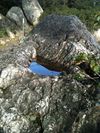
The Berkeley Hills are part of the Pacific Coast Ranges, and run in a northwest–southeast alignment. In Berkeley, the hills consist mainly of a soft, crumbly rock with outcroppings of harder material of old (and extinct) volcanic origin. These rhyolite formations can be seen in several city parks and in the yards of a number of private residences. Indian Rock Park in the northeastern part of Berkeley near the Arlington/Marin Circle features a large example.
Berkeley is traversed by the Hayward Fault, a major branch of the San Andreas Fault to the west. No large earthquake has occurred on the Hayward Fault near Berkeley in historic times (except possibly in 1836), but seismologists warn about the geologic record of large temblors several times in the deeper past, and their current assessment is that a quake of 6.5 or greater is imminent, sometime within the next 30 years.
The 1868 Hayward earthquake did occur on the southern segment of the Hayward Fault[6] in the vicinity of today's city of Hayward (hence, how the fault got its name). This quake destroyed the county seat of Alameda County then located in San Leandro and it subsequently moved to Oakland. It was strongly felt in San Francisco, causing major damage, and experienced by Samuel Clemens (Mark Twain).[7] It was regarded as the "Great San Francisco Quake" prior to 1906. The quake produced a furrow in the ground along the fault line in Berkeley, across the grounds of the new State Asylum for the Deaf, Dumb and Blind then under construction, which was noted by one early University of California professor. Though no significant damage was reported to most of the few Berkeley buildings of the time, the 1868 quake did destroy the vulnerable adobe home of Domingo Peralta in north Berkeley.[8]
Today, evidence of the Hayward Fault's "creeping" is visible at various locations in Berkeley. Cracked roadways, sharp jogs in streams, and springs mark the fault's path. However, since it cuts across the base of the hills, the creep is often concealed by or confused with slide activity. Some of the slide activity itself, however, results from movement on the Hayward Fault.
A notorious segment of the Hayward Fault runs lengthwise down the middle of Memorial Stadium at the mouth of Strawberry Canyon on the University of California campus. Photos and measurements show the movement of the fault through the stadium.
Climate
Berkeley has a Mediterranean climate, with dry summers and wet winters. The summers are cooler than a typical Mediterranean climate thanks to upwelling ocean currents along the California coast. These help produce cool and foggy nights and mornings. Berkeley's location directly opposite the Golden Gate ensures that typical eastward fog flow blankets the city more often than its neighbors.[9]
Winter is punctuated with rainstorms of varying ferocity and duration, but also produces stretches of bright sunny days and clear cold nights. It does not normally snow, though occasionally the hilltops get a dusting. Spring and fall are transitional and intermediate, with some rainfall and variable temperature. Summer typically brings night and morning low clouds or fog, followed by sunny, warm days. The warmest and driest months are typically June through September, with the highest temperatures occurring in September. Mid-summer (July–August) is often a bit cooler due to the sea breezes and fog common then.
The National Weather Service cooperative station's records since 1919 show that January, the coldest month, has an average maximum of 56.2 °F (13.4 °C) and an average minimum of 42.9 °F (6.1 °C). September, the warmest month, has an average maximum of 71.8 °F (22.1 °C) and an average minimum of 55.0 °F (12.8 °C). Annually, there are an average of 2.9 days with highs of 90 °F (32 °C) or higher and an average of 1.0 days with lows of 32 °F (0 °C) or lower. The highest temperature recorded was 107 °F (42 °C) on June 15, 2000, and the lowest temperature recorded was 25 °F (−4 °C) on January 21, 1937, and December 9, 1972.
Average annual precipitation is 23.57 in (599 mm). The wettest year was 1983 with 48.42 in (1,230 mm) and the driest year was 1929 with 9.89 in (251 mm). The wettest month on record was December 1955 with 15.04 in (382 mm). No measurable rainfall has been common during the summer months. The most rainfall in 24 hours was 6.98 in (177 mm) on January 4, 1982. Although snowfall is rare in the lowlands, averaging only 0.1 in (2.5 mm) each year, 6.0 in (150 mm) fell on January 29, 1922. Snow has generally fallen every several years on the higher peaks of the Berkeley Hills.[10]
| Berkeley, California | ||||||||||||||||||||||||||||||||||||||||||||||||||||||||||||
|---|---|---|---|---|---|---|---|---|---|---|---|---|---|---|---|---|---|---|---|---|---|---|---|---|---|---|---|---|---|---|---|---|---|---|---|---|---|---|---|---|---|---|---|---|---|---|---|---|---|---|---|---|---|---|---|---|---|---|---|---|
| Climate chart () | ||||||||||||||||||||||||||||||||||||||||||||||||||||||||||||
|
||||||||||||||||||||||||||||||||||||||||||||||||||||||||||||
|
||||||||||||||||||||||||||||||||||||||||||||||||||||||||||||
In the late spring and early fall, strong offshore winds of sinking air typically develop, bringing heat and dryness to the area. In the spring, this is not usually a problem as vegetation is still moist from winter rains, but extreme dryness prevails by the fall, creating a danger of wildfires. In September 1923 a major fire swept through the neighborhoods north of the University campus, stopping just short of downtown. (See 1923 Berkeley fire). On October 20, 1991, gusty, hot winds fanned a conflagration along the Berkeley–Oakland border, killing 25 people and injuring 150, as well as destroying 2,449 single-family dwellings and 437 apartment and condominium units. (See 1991 Oakland firestorm)
| Month | Jan | Feb | Mar | Apr | May | Jun | Jul | Aug | Sep | Oct | Nov | Dec |
|---|---|---|---|---|---|---|---|---|---|---|---|---|
| Avg high temp. °F (°C) | 56 (13) |
59 (15) |
61 (16) |
64 (18) |
67 (19) |
70 (21) |
70 (21) |
71 (22) |
72 (22) |
70 (21) |
62 (17) |
57 (14) |
| Avg low temp. °F (°C) | 44 (7) |
46 (8) |
47 (8) |
49 (9) |
51 (11) |
54 (12) |
55 (13) |
56 (13) |
56 (13) |
53 (12) |
48 (9) |
44 (7) |
| Rainfall in. (cm) | 5.1 (13) |
4.8 (12) |
4.1 (10) |
1.6 (4) |
0.6 (2) |
0.1 (0.25) |
0.1 (0.25) |
0.1 (0.25) |
0.4 (1) |
1.4 (3) |
3.6 (9) |
3.5 (9) |
Demographics
| Population | |
| 1890 | 5,101 |
| 1900 | 13,214 |
| 1910 | 40,434 |
| 1920 | 56,036 |
| 1930 | 82,109 |
| 1940 | 85,547 |
| 1950 | 113,805 |
| 1960 | 111,268 |
| 1970 | 116,716 |
| 1980 | 103,328 |
| 1990 | 102,724 |
| 2000 | 102,743† |
| 2005 | 100,744‡ |
| 2007 | 101,377‡ |
| † | 2000 Census[12] |
| ‡ | City Data estimate (2005 and 2007)[13] |
As of the census[14] of 2000, there were 102,743 people, 44,955 households, and 18,656 families residing in the city. The population density was 9,823.3[15] people per square mile (3,792.5/km²), one of the highest in California. There were 46,875 housing units at an average density of 4,481.8/sq mi (1,730.3/km²). The racial makeup of the city was 59.17% White, 16.39% Asian, 13.63% Black or African American, 0.45% Native American, 0.14% Pacific Islander, 4.64% from other races, and 5.57% from two or more races. 9.73% of the population were Hispanic or Latino of any race. Non-Hispanic whites accounted for 55.18% of the city's population. 7.3% were of German, 7.2% English and 6.3% Irish ancestry according to Census 2000. 73.1% spoke English, 8.3% Spanish, 4.5% Chinese or Mandarin, 1.6% French, 1.2% Korean, 1.1% Japanese and 1.0% German as their first language.
There were 44,955 households, out of which 17.8% had children under the age of 18 living with them, 28.9% were married couples living together, 9.5% had a female householder with no husband present, and 58.5% were non-families and/or unmarried couples. 38.1% of all households were made up of individuals and 7.9% had someone living alone who was 65 years of age or older. The average household size was 2.16 and the average family size was 2.84.
In the city the population was spread out with 14.1% under the age of 18, 21.6% from 18 to 24, 31.8% from 25 to 44, 22.3% from 45 to 64, and 10.2% who were 65 years of age or older. The median age was 32 years. For every 100 females there were 96.5 males. For every 100 females age 18 and over, there were 95.1 males.
According to a 2007 estimate, the median income for a household in the city was $57,189, and the median income for a family was $93,297.[16] Males had a median income of $50,789 versus $40,623 for females. The per capita income for the city was $30,477. About 8.3% of families and 20.0% of the population were below the poverty line, including 13.4% of those under age 18 and 7.9% of those age 65 or over. Population is estimated to have reduced slightly since the 2000 census.[13]
Transportation
Berkeley is served by Amtrak (Capitol Corridor), AC Transit, BART (Downtown Berkeley Station, North Berkeley, and Ashby Station) and bus shuttles operated by major employers including UC Berkeley and Lawrence Berkeley National Laboratory. The Eastshore Freeway (Interstate 80 and Interstate 580) runs along the bay shoreline. Each day there is an influx of thousands of cars into the city by commuting UC faculty, staff and students, making parking for more than a few hours an expensive proposition.
Berkeley has one of the highest rates of bicycle and pedestrian commuting in the nation. Berkeley is the safest city of its size in California for pedestrians and cyclists, considering the number of injuries per pedestrian and cyclist, rather than per capita.[17]
Berkeley has modified its original grid roadway structure through use of diverters and barriers, moving most traffic out of neighborhoods and onto arterial streets (visitors often find this confusing, because the diverters are not shown on all maps). Berkeley maintains a separate grid of arterial streets for bicycles, called Bicycle Boulevards, with bike lanes and lower amounts of car traffic than the major streets they often parallel.
Berkeley hosts car sharing networks run by City CarShare, U Car Share, and Zipcar. Rather than owning (and parking) their own cars, members share a group of cars parked nearby. Web- and telephone-based reservation systems keep track of hours and charges. Several "pods" (points of departure where cars are kept) exist throughout the city, in several downtown locations, at the Ashby and North Berkeley BART stations, and at various other locations in Berkeley (and other cities in the region). Using alternative transportation is encouraged.
Berkeley has had recurring problems with parking meter vandalism. In 1999, over 2,400 Berkeley meters were jammed, smashed, or sawed apart.[18] Starting in 2005 and continuing into 2006, Berkeley began to phase out mechanical meters in favor of more centralized electronic meters.
Transportation past
The first commuter service to San Francisco was provided by the Central Pacific's Berkeley Branch Railroad, a standard gauge steam railroad, which terminated in downtown Berkeley, and connected in Emeryville (at a locale then known as "Shellmound") with trains to the Oakland ferry pier as well as with the Central Pacific main line starting in 1876. The Berkeley Branch line was extended from Shattuck and University to Vine Street ("Berryman's Station") in 1878. Starting in 1882, Berkeley trains ran directly to the Oakland Pier.[19] In the 1880s, Southern Pacific assumed operations of the Berkeley Branch. In 1911, Southern Pacific electrified this line and the several others it constructed in Berkeley, creating its East Bay Electric Lines division. The huge and heavy cars specially built for these lines came to be called the "Red Trains" or the "Big Red Cars." The Shattuck line was extended and connected with two other Berkeley lines (the Ninth Street Line and the California Street line) at Solano and Colusa (the "Colusa Wye"). It was at this time that the Northbrae Tunnel and the Rose Street Undercrossing were constructed, both of which still exist (the Rose Street Undercrossing is not accessible to the public, being situated between what is now two backyards). The fourth Berkeley line was the Ellsworth St. line to the university campus. The last Red Trains ran in July, 1941.
The first electric rail service in Berkeley was provided by several small streetcar companies starting in 1891. Most of these were eventually bought up by the Key System of Francis "Borax" Smith who added lines and improved equipment. The Key System's streetcars were operated by its East Bay Street Railways division. Principal lines in Berkeley ran on Euclid, The Arlington, College, Telegraph, Shattuck, San Pablo, University, and Grove (today's Martin Luther King Jr. Way). The last streetcars ran in 1948, replaced by buses.
The first electric commuter interurban-type trains to San Francisco from Berkeley were put in operation by the Key System in 1903, several years before the Southern Pacific electrified its steam commuter lines. Like the SP, Key trains ran to a pier serviced by the Key's own fleet of ferryboats, which also docked at the Ferry Building in San Francisco. After the Bay Bridge was built, the Key trains ran to the Transbay Terminal in San Francisco, sharing tracks on the lower deck of the Bay Bridge with the SP's red trains and the Sacramento Northern Railroad. It was at this time that the Key trains acquired their letter designations, which were later preserved by Key's public successor, AC Transit. Today's F bus is the successor of the F train. Likewise, the E, G and the H. Before the Bridge, these lines were simply the Shattuck Avenue Line, the Claremont Line, the Westbrae Line, and the Sacramento Street Line, respectively.
After the Southern Pacific abandoned transbay service in 1941, the Key System acquired the rights to use its tracks and catenary on Shattuck north of Dwight Way and through the Northbrae Tunnel to The Alameda for the F-train. The SP tracks along Monterey Avenue as far as Colusa had been acquired by the Key System in 1933 for the H-train, but were abandoned in 1941. The Key System trains stopped running in April 1958. In 1963, the Northbrae Tunnel was opened to auto traffic.
Places
Major streets
- Shattuck Avenue passes through several neighborhoods, including the downtown business district in Berkeley. It is named for Francis K. Shattuck, one of Berkeley's earliest influential citizens.
- University Avenue runs from Berkeley's bayshore and marina to the University of California campus.
- Ashby Avenue (Highway 13), which also runs from Berkeley's bayshore to the hills, connects with the Warren Freeway and Highway 24 leading to the Caldecott Tunnel, named for a former Berkeley mayor.
- San Pablo Avenue (Highway 123) runs north–south through West Berkeley, connecting Oakland and Emeryville to the south and Albany to the north.
- Telegraph Avenue, which runs north-south from the University Campus to Oakland, historically the site of much of the "hippie" presence in Berkeley.
- Martin Luther King Jr. Way, which until 1984 was called Grove St, runs north-south a few blocks west of Shattuck Avenue, connecting Oakland and the freeways to the south with the neighborhoods and other communities to the north.
- Solano Avenue, a major street for shopping and restaurants, runs east-west near the north end of Berkeley, continuing into Albany.
Freeways
- The Eastshore Freeway (I-80 & I-580) runs along Berkeley's bayshore with exits at Ashby Avenue, University Avenue and Gilman Street.
Bicycle and pedestrian paths
- Ohlone Greenway
- San Francisco Bay Trail
- Berkeley I-80 bridge – opened in 2002, an arch-suspension bridge spanning Interstate 80, for bicycles and pedestrians only, giving access from the city at the foot of Addison Street to the San Francisco Bay Trail, the Eastshore State Park and the Berkeley Marina.
- Berkeley's Network of Historic Pathways – Berkeley has a network of historic pathways that link the winding neighborhoods found in the hills and offer panoramic lookouts over the East Bay. A complete guide to the pathways may be found at Berkeley Path Wanderers Association
- Maps of Berkeley's network of bicycle routes can be accessed from the City of Berkeley web site: Bicycling and Walking Maps and Guides
Neighborhoods
Berkeley has a number of distinct neighborhoods.
Surrounding the University of California campus are the most densely populated parts of the city. West of the campus is Downtown Berkeley, the city's traditional commercial core; home of the civic center, the city's only public high school, the busiest BART station in Berkeley, as well as a major transfer point for AC Transit buses. South of the campus is the Southside neighborhood, mainly a student ghetto, where much of the university's student housing is located. The busiest stretch of Telegraph Avenue is in this neighborhood. North of the campus is the quieter Northside neighborhood, the location of the Graduate Theological Union.
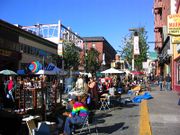
Further from the university campus, the influence of the University quickly becomes less visible. Most of Berkeley's neighborhoods are primarily made up of detached houses, often with separate in-law units in the rear, although larger apartment buildings are also common in many neighborhoods. Commercial activities are concentrated along the major avenues and at important intersections. In the southeastern corner of the city is the Claremont District, home to the Claremont Hotel; and the Elmwood District, with a small shopping area on College Avenue. West of Elmwood is South Berkeley, known for its weekend flea market at the Ashby BART station. West of (and including) San Pablo Avenue, a major commercial corridor, is West Berkeley, the historic commercial center of the city, and the former unincorporated town of Ocean View. West Berkeley contains the remnants of Berkeley's industrial area, much of which has been replaced by retail and office uses, as well as residential live/work loft space, with the decline of manufacturing in the United States.
The areas of South and West Berkeley are in the midst of redevelopment. Some residents have opposed redevelopment in this area.
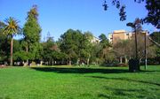
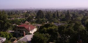
Along the shoreline of San Francisco Bay at the foot of University Avenue is the Berkeley Marina. Nearby is Berkeley's Aquatic Park, featuring an artificial linear lagoon of San Francisco Bay. North of Downtown is the North Berkeley neighborhood, which has been nicknamed the "Gourmet Ghetto" because of the concentration of well-known restaurants and other food-related businesses. Further north are Northbrae, a master-planned subdivision from the early 20th century, and Thousand Oaks. Above these last three neighborhoods, in the northeastern part of Berkeley, are the Berkeley Hills. The neighborhoods of the Berkeley Hills such as Cragmont and La Loma Park are notable for their dramatic views, winding streets, and numerous public stairways and paths.
Points of interest
- University of California, Berkeley
- Berkeley Art Museum and Pacific Film Archive
- Berkeley Marina
- Berkeley History Center (1931 Center St.)
- Berkeley Public Library (Shattuck Avenue at Kittridge Street)
- Berkeley Repertory Theatre
- Berkeley Rose Garden
- Cloyne Court Hotel, a member of the Berkeley Student Cooperative
- Hearst Greek Theatre (home of the annual Berkeley Jazz Festival)
- Judah L. Magnes Museum
- Lawrence Berkeley National Laboratory
- Lawrence Hall of Science
- Regional Parks Botanic Garden
- Tilden Regional Park
- University of California Botanical Garden
Other notable places include:
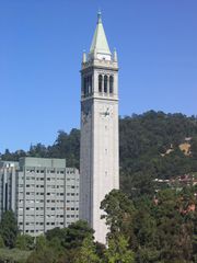
- The Campanile (Sather Tower) in the University of California, Berkeley campus.
- Telegraph Avenue and People's Park, both known as centers of the counterculture of the 1960s.
- Chez Panisse - founded in 1971 and the birthplace of California cuisine.[20]
- Cody's Books - founded in 1956 and closed in 2008, Cody's was "a pioneer in bookselling, bringing the paperback revolution to Berkeley, fighting censorship, and providing a safe harbor from teargas for student activists during the Free Speech Movement and throughout the 1960s and 70s." [21]
- The Freight and Salvage - founded in 1968, this is a nonprofit musical performance venue that primarily hosts folk music and world music acts
- The Cheese Board - founded in 1967/71, this business comprises two collectively owned and operated businesses.
- Whole Earth Access - founded in 1969 and closed in 1998, this was initially established as a countercultural retail store inspired by Stewart Brand's Whole Earth Catalog.[22]
- The Claremont Resort - founded in 1906, this historic site was originally the Claremont Hotel. Although the main hotel building lies entirely within the city limits of adjacent Oakland, a portion of the grounds lie within Berkeley, and the resort uses this for its street address.
- 924 Gilman - founded in 1986, this is an all-ages, non-profit, collectively organized music club where Berkeley natives Operation Ivy, Pansy Division, Green Day, Rancid, Tiger Army and AFI started out.
- The Other Change of Hobbit - A Science Fiction and Fantasy bookstore first opened in 1977.
- Caffe Mediterraneum - Birthplace of the caffe latte in 1959 - invented by owner Lino Meiorin. Allen Ginsberg wrote part of Howl at "Caffe Med."[23][24]
- the Berkeley Free Clinic, a free clinic operating since 1969.
Landmarks and Historic Districts
165 buildings in Berkeley are designated as local landmarks or local structures of merit. Of these, 49 are listed in the National Register of Historic Places, including:
- Berkeley High School (the city's only public high school) and the Berkeley Community Theatre, which is on its campus.[25]
- Berkeley Women’s City Club, now Berkeley City Club – Julia Morgan (1929–30)
- First Church of Christ, Scientist – Bernard Maybeck (1910)
- Studio Building – ? (1905)
- William R. Thorsen House, now Sigma Phi Society Chapter House – Charles Sumner Greene & Henry Mather Greene (1908–10)
Historic Districts listed in the National Register of Historic Places:
- George C. Edwards Stadium – Located at intersection of Bancroft Way and Fulton Street on University of California, Berkeley campus (80 acres (32 ha), 3 buildings, 4 structures, 3 objects; added 1993).
- Site of the Clark Kerr Campus, UC Berkeley - until 1980, this location housed the State Asylum for the Deaf, Dumb and Blind, also known as The California Schools for the Deaf and Blind – Bounded by Dwight Way, the City line, Derby Street, and Warring Street (500 acres (2.0 km2), 20 buildings; added 1982). The school was closed in 1980 and the Clark Kerr Campus was opened in 1986.
See List of Berkeley Landmarks, Structures of Merit, and Historic Districts
Arts and culture
Annual events
- Jewish Music Festival website – March
- Cal Day University of California, Berkeley Open House website – April
- Berkeley Arts Festival website – April and May
- Himalayan Fair website – May
- Berkeley Kite Festival website – late July weekend
- How Berkeley Can You Be!? Parade and Festival website – September
- Solano Stroll – September
Schools
The first public school in Berkeley was the Ocean View School, now the site of the Berkeley Adult School located at Virginia Street and San Pablo Avenue. The public schools today are administered by the Berkeley Unified School District. In the 1960s, Berkeley was one of the earliest US cities to voluntarily desegregate, utilizing a system of buses, still in use. The city has only one public high school, Berkeley High School (BHS), established in 1880. The Berkeley High campus was designated a historic district by the National Register of Historic Places on January 7, 2008.[26] Saint Mary's College High School, a Catholic school, has its street address in Berkeley, although most of the grounds and buildings are actually in neighboring Albany. Berkeley has eleven elementary schools and three middle schools. There is also the Bay Area Technology school, the only school in the whole Bay Area to offer a technology- and science-based curriculum, with major connections to leading universities. In addition, Berkeley City College is a community college in the Peralta Community College District.
Notable people
- List of people from Berkeley, California
- List of Berkeley High School (Berkeley, California) people
Mayors
City of Berkeley Mayor's Office
- Presidents, Town Board of Trustees (1878–1909)
- Abel Whitton (Workingman's Party) 1878–1881
- A. McKinstry 1881–1883
- W.C. Wright (Republican) 1883–1885
- J.B. Henley 1885–1887
- Henry L. Whitney 1887–1889
- Samuel Heywood / Joseph L. Scotchler (Republican) 1889–1891
- Reuben Rickard (Republican) 1891–1893
- Byron E. Underwood / Martin J. Acton / Charles S. Preble 1893–1895
- Reuben Rickard (Republican) 1895
- John W. Richards 1895–1899
- William H. Marston 1899–1903
- Thomas Rickard (Republican) 1903–1909
- Mayors
- (Mr.) Beverly L. Hodghead (Democrat) 1909–1911
- Jackson Stitt Wilson (Socialist) 1911–1913
- Charles D. Heywood (Republican) 1913–1915
- Samuel C. Irving (Democrat) 1915–1919
- Louis Bartlett (Republican) 1919–1923
- Frank D. Stringham (Republican) 1923–1927
- Michael B. Driver (Republican) 1927–1930
- Thomas E. Caldecott (Republican) 1930–1932
- Edward N. Ament (Republican) 1932–1939
- Frank S. Gaines (Republican) 1939–1943
- Fitch Robertson (Republican) 1943–1946
- Carrie L. Hoyt (Republican) 1947 (January–April)
- Laurance L. Cross (Democrat) 1947–1955
- Claude B. Hutchison (Republican) 1955–1963
- Wallace Johnson (Republican) 1963–1971
- Warren Widener (Democrat) 1971–1979
- Gus Newport, (Berkeley Citizens [sic] Action) 1979–1986
- Loni Hancock, (Berkeley Citizens Action) 1986–1994
- Jeffrey Shattuck Leiter, 1994 (March–December)
- Shirley Dean, (Berkeley Democrat Club) 1994–2002
- Tom Bates, 2002–
Sister cities
Berkeley has thirteen sister cities:[27]
 Gao, Mali
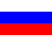 Dmitrov, Russia
 Blackfeet Nation, Montana, United States
 Jena, Germany
- Ulan-Ude, Buryatia, Russia
- Yurok Tribe, California, United States
 Uma-Bawang, Malaysia
 Sakai, Osaka, Japan
 San Antonio Los Ranchos, El Salvador
 Oukasie, South Africa
 Yondó, Colombia
 Palma Soriano, Cuba
 León, Nicaragua
References
- ↑ "Study Ranks America's Most Liberal and Conservative Cities". Bay Area Center for Voting Research. August 16, 2005. http://govpro.com/content/gov_imp_31439/index.html.
- ↑ Berkeley Gazette. 1900 April 9
- ↑ Berkeley 1900: Daily Life at the Turn of the Century, by Richard Schwartz. 2000. page 187
- ↑ Durham, David L. (1998). California's Geographic Names: A Gazetteer of Historic and Modern Names of the State. Quill Driver Books. p. 601. ISBN 9781884995149.
- ↑ "US Gazetteer files: 2000 and 1990". United States Census Bureau. 2005-05-03. http://www.census.gov/geo/www/gazetteer/gazette.html. Retrieved 2008-01-31.
- ↑ http://query.nytimes.com/mem/archive-free/pdf?res=9801E5DB1E3CE13BBC4A51DFB6678383679FDE query.nytimes.com
- ↑ http://etext.virginia.edu/etcbin/toccer-new2?id=TwaRoug.sgm&images=images/modeng&data=/texts/english/modeng/parsed&tag=public&part=58&division=div1 etext.virginia.edu
- ↑ Lawson, A. C. (ed.), “The California Earthquake of April 18, 1906”, 1908, Reprinted 1969 by the Carnegie Institution of Washington. This is a comprehensive report on the 1906 earthquake, published by the State Earthquake Investigation Commission, and comprises two volumes and an atlas. It contains a discussion of the 1868 Hayward Fault earthquake and its effects, and includes a number of photos taken by Lawson himself of damage in Berkeley caused by the 1906 quake. The report is available from the USGS here.
- ↑ Jane Houston Jones. San Francisco Weather – Weird and Wacky. SJAA Ephemeris July 2001.
- ↑ Western Regional Climate Center Web site
- ↑ Monthly Averages for Berkeley, Weather.com, Accessed July 12, 2009.
- ↑ Population, City of Berkeley.
- ↑ 13.0 13.1 Statistics of Berkeley, California, City Data.com
- ↑ "American FactFinder". United States Census Bureau. http://factfinder.census.gov. Retrieved 2008-01-31.
- ↑ census bureau quick facts: http://quickfacts.census.gov/qfd/states/06/0606000.html
- ↑ http://factfinder.census.gov/servlet/STTable?_bm=y&-context=st&-qr_name=ACS_2007_1YR_G00_S1901&-ds_name=ACS_2007_1YR_G00_&-CONTEXT=st&-tree_id=307&-redoLog=false&-_caller=geoselect&-geo_id=16000US0606000&-format=&-_lang=en factfinder.census.gov
- ↑ Bicycle and Pedestrian Safety in Berkeley, City of Berkeley.
- ↑ “Chicanery tops meters in Berkeley”, San Francisco Chronicle.
- ↑ Berkeley Gazette, January 22, 1903
- ↑ Weinstein, Dave (2008). It Came from Berkeley. Gibbs Smith. ISBN 1423602544. http://www.gibbs-smith.com/productdetails.cfm?PC=2263.
- ↑ Paperback Dreams
- ↑ Victor F. Zonana. "One of the Fastest-Growing Chains in U.S.: Whole Earth Access Stores are Bargain Basement for Yuppies." Los Angeles Times, May 19, 1986: E2
- ↑ Lifehack photos and posts of Caffe Mediterraneum
- ↑ Davids, Kenneth (2001). Coffee: A Guide to Buying, Brewing, and Enjoying. St. Martin's Griffin. pp. 153. ISBN 031224665X. http://books.google.com/books?id=IqJsIcYOPcQC.
- ↑ Berkeley High
- ↑ Berkeley Daily Planet, January 22–24, 2008
- ↑ Sister cities designated by Sister Cities International, Inc. (SCI). Retrieved on May 3, 2007.
External links
- Official Government Website
- Berkeley Historical Society
- Finding Aid to City of Berkeley Records, The Bancroft Library
- Berkeley (California) travel guide from Wikitravel
- Berkeley Wiki
 |
Albany | El Cerrito, Kensington | |
|
| Orinda Moraga |
||||
| Emeryville | Oakland |
|
|||||||||||||||||
|
|||||||||||||||||||||||||
|
||||||||||||||||||||
|
|||||||||||||||||